As Lucien S. shared Facebook on January 25th, Hamilton County installed a new online stream gauge on N Chick at the Ivy Academy, just upstream of the Dayton Pike bridge. Lucien pointed out that although this gauge is only 0.9 miles above the existing USGS gauge (I actually measured it), it should provide a better correlation with the paddlers’/visual gauge because it’s above the confluence with Poe Branch. I agree. So I contacted the Hamilton County Water Quality Department and they agreed to provide me with an API to start harvesting data from that new gauge. It’s now on the RainPursuit map: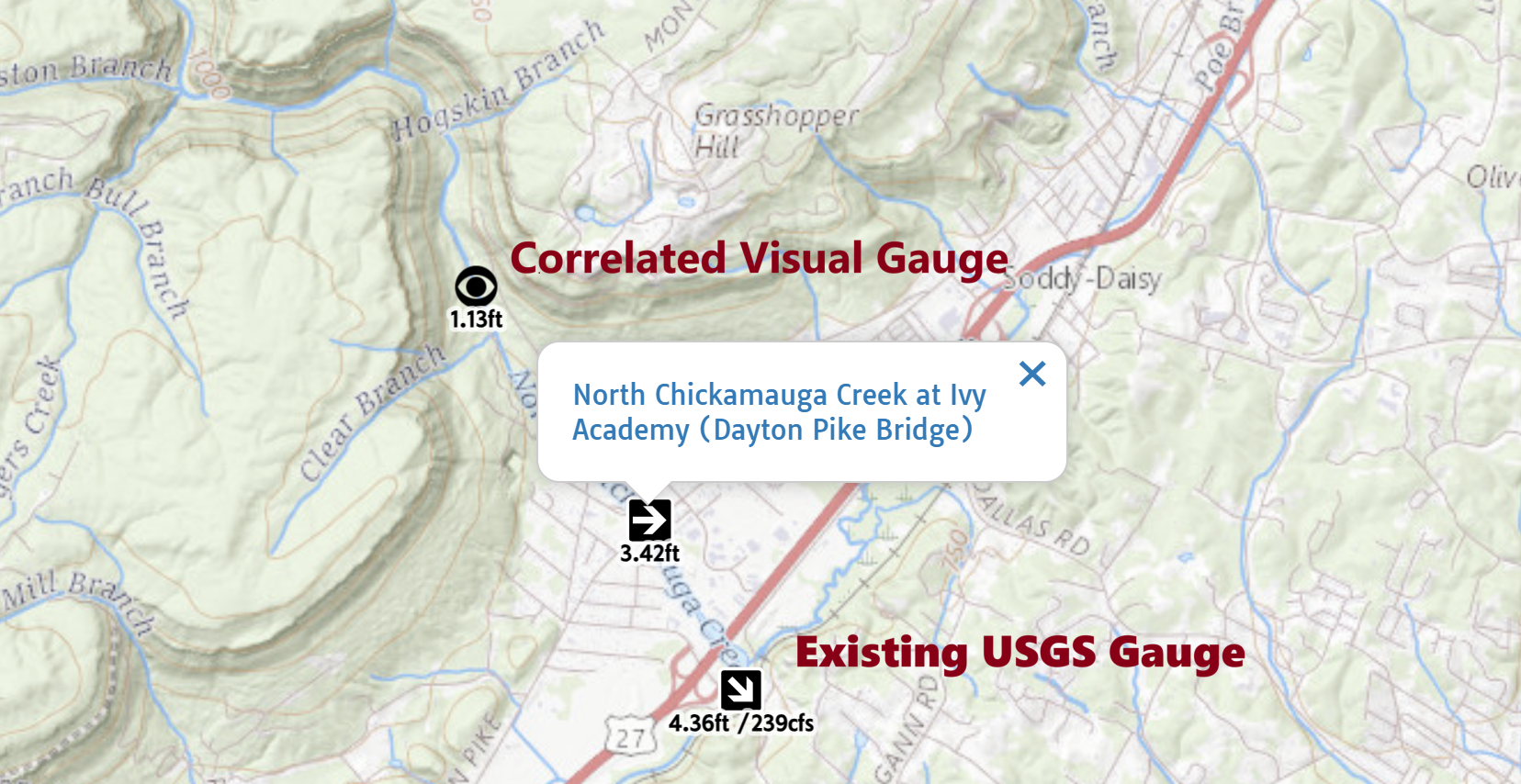
You can also get to it directly here. Eagle.io, the company who is hosting streamflow data for Hamilton County, has a much more sexy chart that you might want to use instead.
As you probably know, the numbers under the ‘eye’ icon are the estimated level on the visual gauge based on the correlation with USGS gauge. I plan to do the same but with the new online gauges at Ivy School.
I built that correlation with the USGS gauge using this spreadsheet. The correlation that it built is below.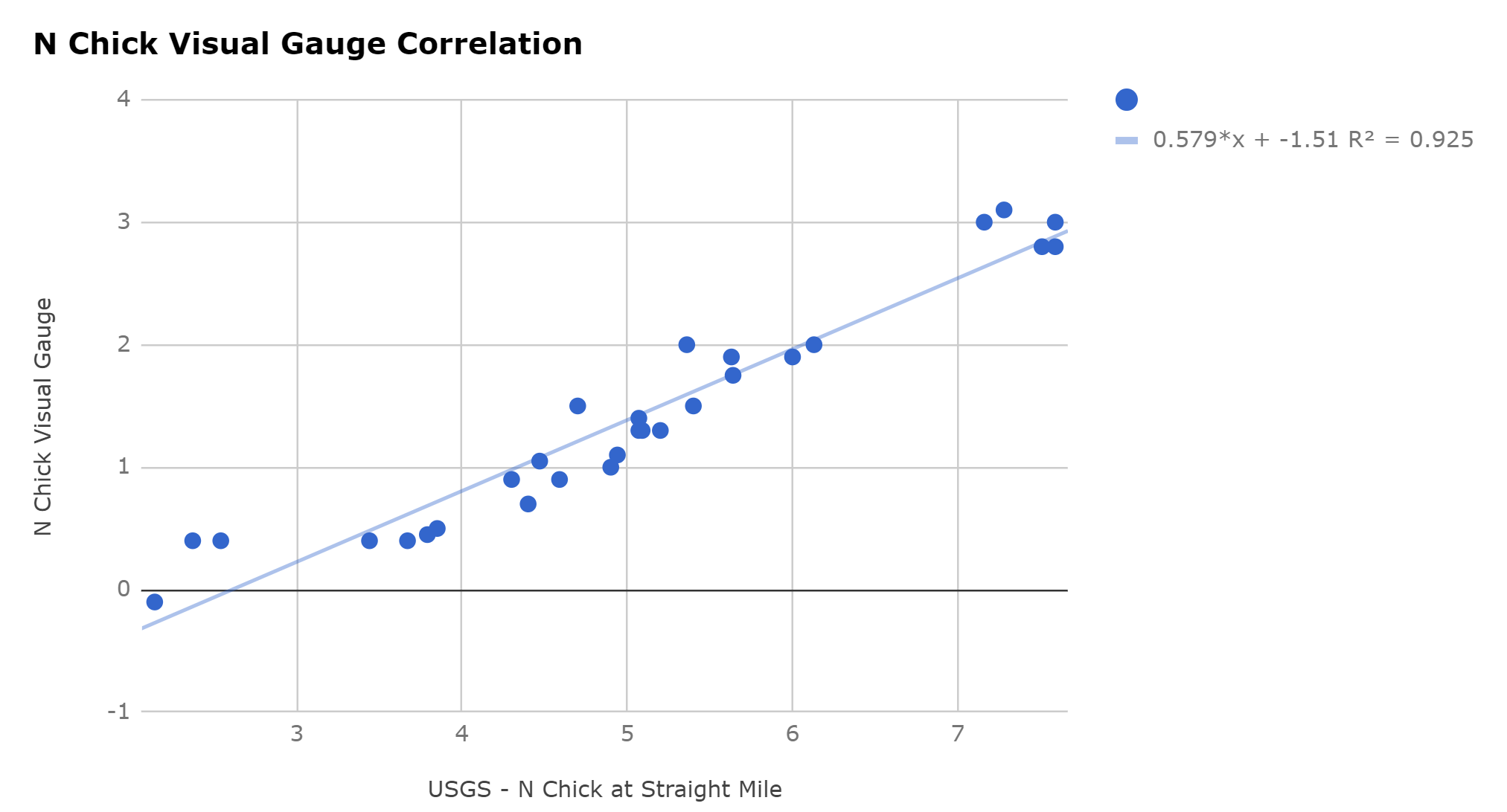
I just made a copy of that spreadsheet and it’s just waiting to be populated to build a correlation with the new gauge. Keep posting N Chick visuals on Facebook! Once we have sufficient readings to get a good correlation going, I’ll update the correlated visual gauge to use data from the new gauge instead. Let’s hope this new gauge stays online for a long time. Unfortunately, we’ve lost a number of online gauges due to lack of continued funding. Hopefully that won’t happen here.
Cheers!