New North Chick Gauge is on Rain Pursuit.

As Lucien S. shared Facebook on January 25th, Hamilton County installed a new online stream gauge on N Chick at the Ivy Academy, just upstream of the Dayton Pike bridge. Lucien pointed out that although this gauge is only 0.9 miles above the existing USGS gauge (I actually measured it), it should provide a better correlation with the paddlers’/visual gauge because it’s above the confluence with Poe Branch. I agree. So I contacted the Hamilton County Water Quality Department and they agreed to provide me with an API to start harvesting data from that new gauge.

Welcome

This page is all about the map, which you can access here or by clicking the map key image below.  Rain and streamflow gauges are available for the Southeast whitewater region - basically Alabama to the Mason-Dixon line.  Watershed boundaries are available for areas in this region except for James River and Potomac River drainages.
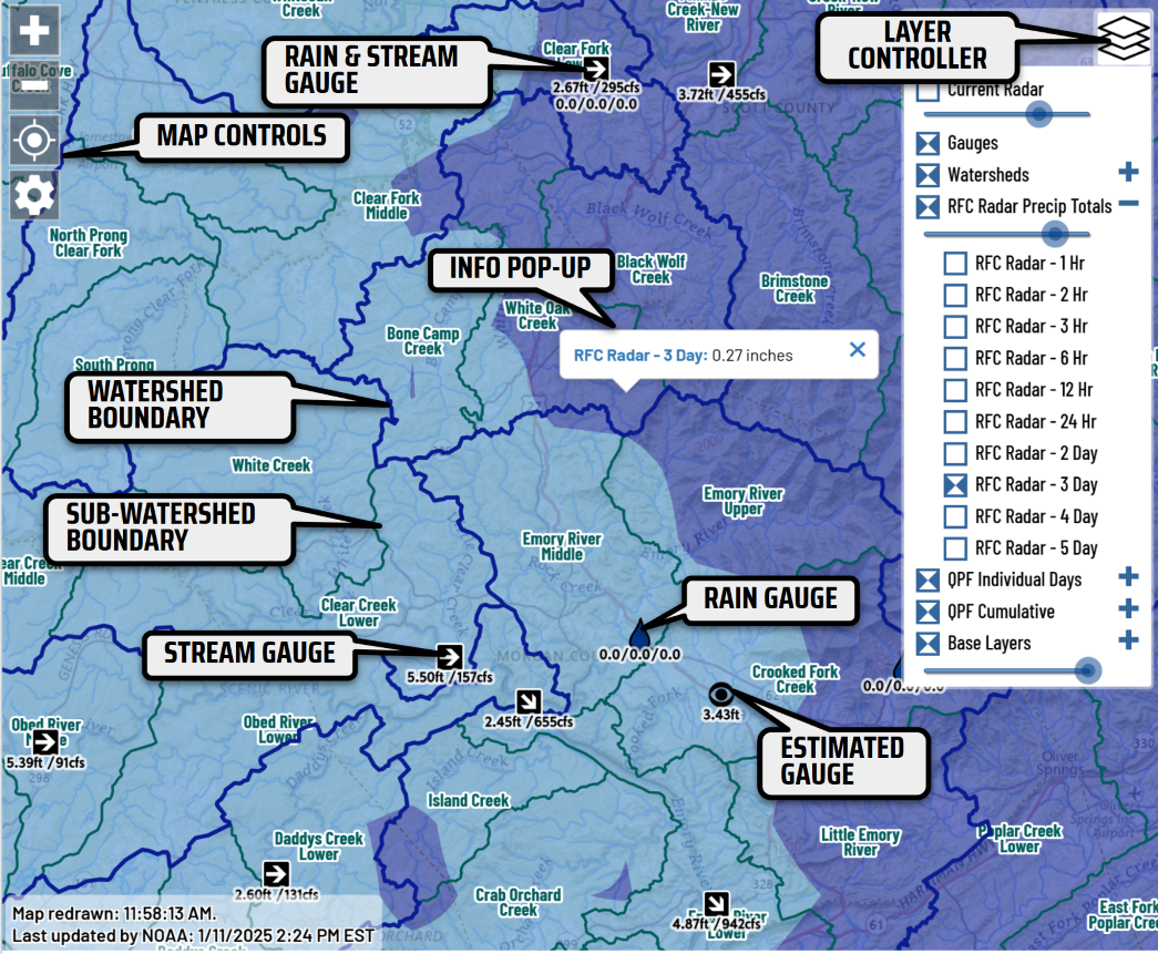
MAP KEY

Subscribe to RainPursuit RSS